 Snowy Roads for iPhone, iPad, and Mac
Version 3.0 Coming November 2026
The app for Tahoe & Sierra winter road conditions
See whether your vehicle needs chains, get chain-control and road-closure alerts, check traffic cameras and message signs, and follow conditions on the way to Tahoe, Mammoth, Big Bear and ski resorts across the Sierra Nevada.

- Free
- No ads
- iOS 18.5+
- Version 2.1
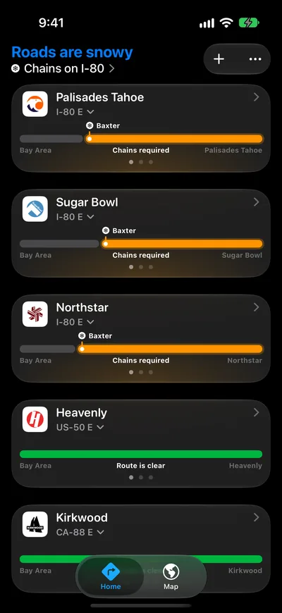
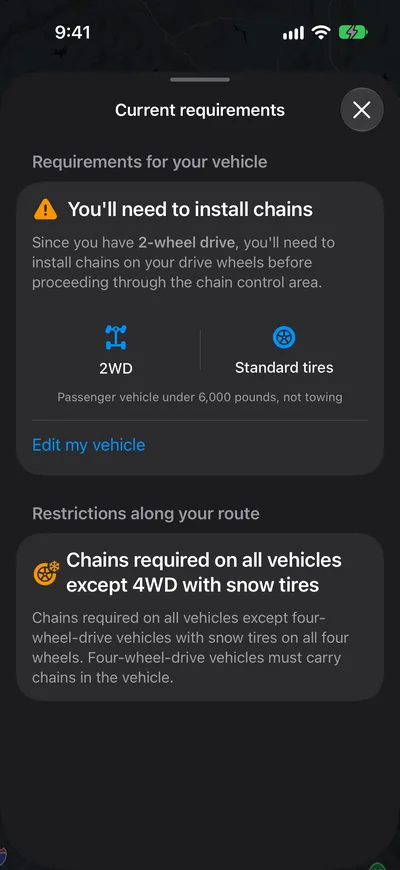
Personalized
Do I need chains? Answered for your car
Tell Snowy Roads what you drive, two-wheel or four-wheel drive, with or without snow tires, and every route spells out what the current chain control means for you; not a legend to decode at the checkpoint.
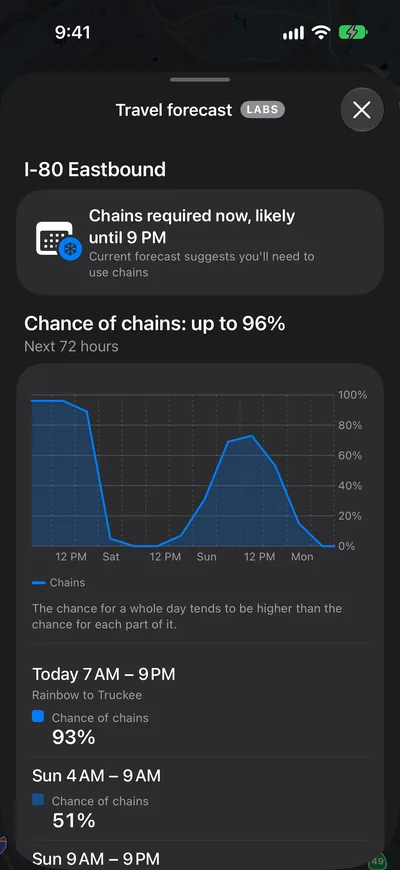
Travel forecastNew in 3.0Labs
See the chance of chains before you plan the trip
On the routes it covers, the travel forecast gives the chance of chain controls for the days ahead, period by period, and when a control in force is likely to lift. It's a Labs feature: a forecast, not a promise, so check the live status before you leave.
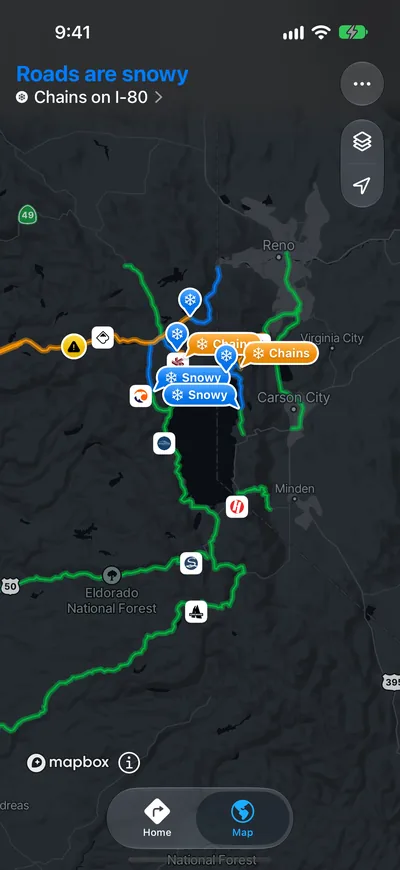
Map
See where chains are required along the way
The route map highlights each stretch that is snowy, under chain control or closed, checkpoint by checkpoint, so you know where controls start and end before you leave.
Alerts & Live ActivitiesNew in 3.0
Know the moment chain control or a closure changes
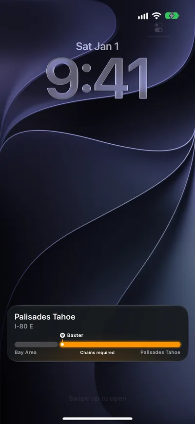
Follow a route and get a notification when chain control goes up or comes down, or the road closes. Start a trip and a Live Activity keeps your route's status on the Lock Screen and in the Dynamic Island, so you stop refreshing. With CarPlay, you can keep it front and center while you drive.
Widgets
Your routes, right on your Home Screen
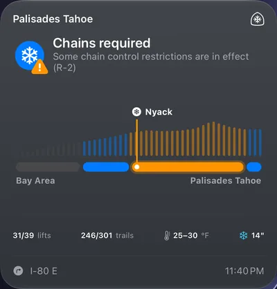
Home Screen widgets show the conditions on your favorite routes at a glance, closures and chain requirements included, without opening the app.
Cameras, signs & travel time
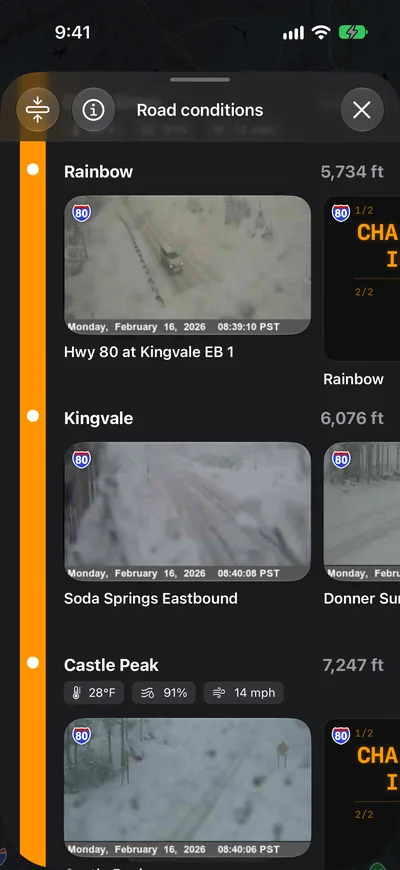
Look at the road before you drive it
Live Caltrans and NDOT traffic cameras, the message signs along your route and travel time from live traffic, all for the exact route you're taking, not a whole-state map.
Resort conditions & weather
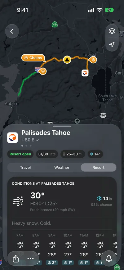
Weather, lift status, and resort info
Hourly and 7-day forecasts, resort webcams and the lifts and trails open at the ski resort you're driving to.
Supported resorts and highways
The routes to 24 ski resorts and the Sierra highways themselves. Every one also has a live page on this site.
North Lake Tahoe
South Lake Tahoe
Central Sierra
Mammoth Lakes
Southern California
Mt. Shasta
Southern Nevada
Interstates
U.S. Routes
California State Routes
No ads. No account. Private by design.
Snowy Roads is free, has no ads and needs no sign-up.
What drivers say
Rated 4.8 out of 5 from 13 ratings on the App Store.
“It's the best road condition App for the Bay Area snowboarders and skiers.”
“Critical for my travel plans! So well designed and easy to use!”
“Someone's passion project that makes life better for everyone”
Questions
Is Snowy Roads free?
Yes. The Snowy Roads iPhone app and the website are free, with no ads and no subscription. A passion project supported by donations from people like you.
Where does the data come from?
Chain control, road closures, traffic cameras and message signs come from Caltrans and the Nevada DOT. Incidents come from the California Highway Patrol, weather forecasts from the National Weather Service, travel time from Mapbox live traffic, and lift status from each resort's own lift report.
Which roads and resorts are supported?
The routes to 24 ski resorts across Lake Tahoe, the Central Sierra, Yosemite, Mammoth, Southern California and Mt. Shasta, and the Sierra highways themselves: I-80 over Donner Pass, US-50 over Echo Summit, SR-88 over Carson Pass, SR-89, US-395, I-5 and more.
Is there an Android app?
No, but on Android, or any phone, snowyroads.app shows the same live chain control, closures, cameras and forecasts in the browser.
Get Snowy Roads for iPhone, iPad, and Mac
Chain requirements for your car and alerts when they change, before you reach the checkpoint.
Free · Requires iOS 18.5 or later · Version 2.1, updated Feb 24, 2026